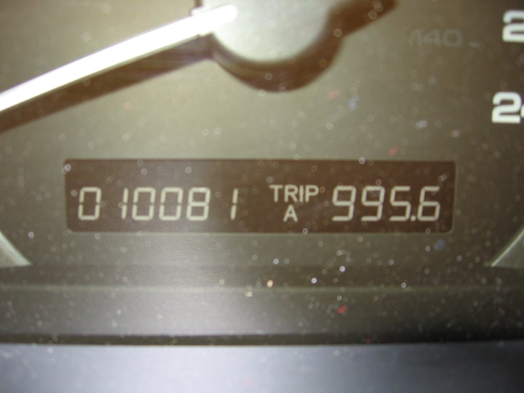
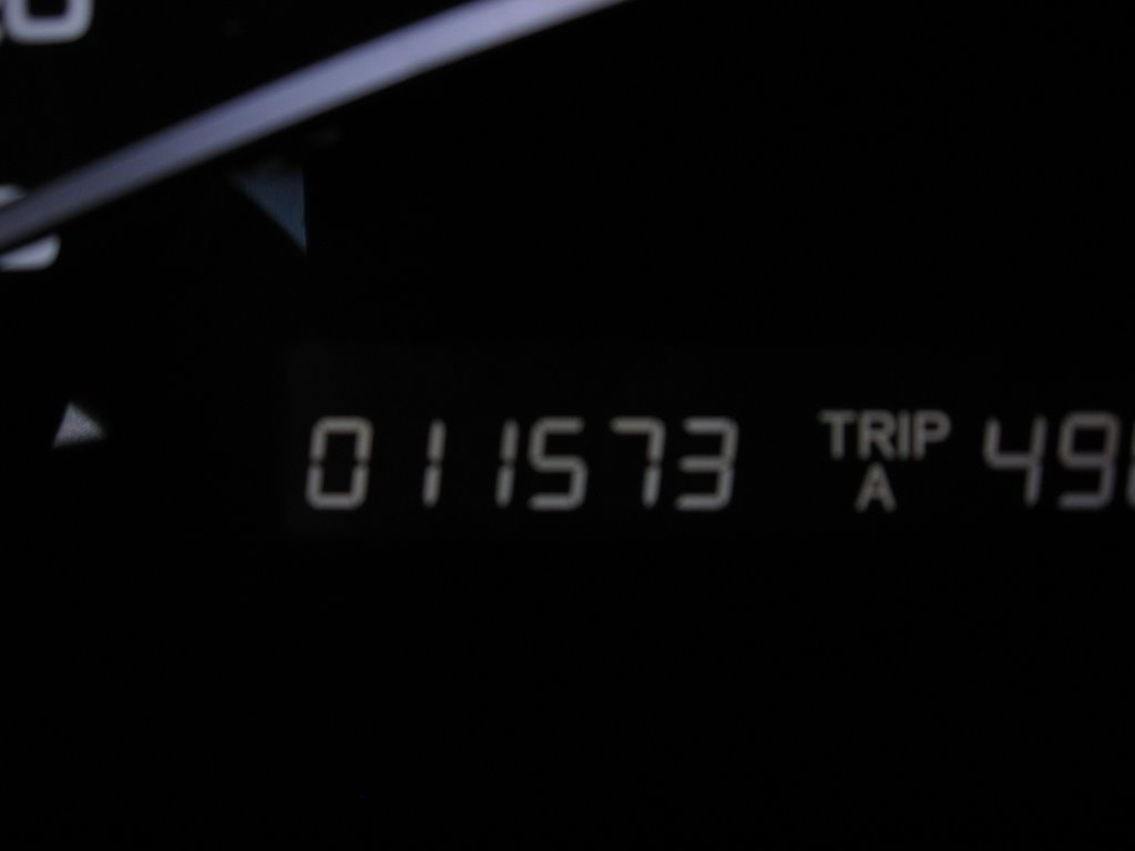
I left my driveway in Fort McMurray at 6:07am Mountain Time with my luggage, my mother's golf clubs, and the family dog in tow. Given the mileage I expect to put on this week, I thought a shot of the odometer reading would be appropriate.

Although I stopped in Westlock for fuel, there was no rest so I didn't bother to take a picture. Beautiful downtown Edson, Alberta (shown here) was the first real stop for a break and a tasty Big Bacon Classic...

... I also got the dog some water.
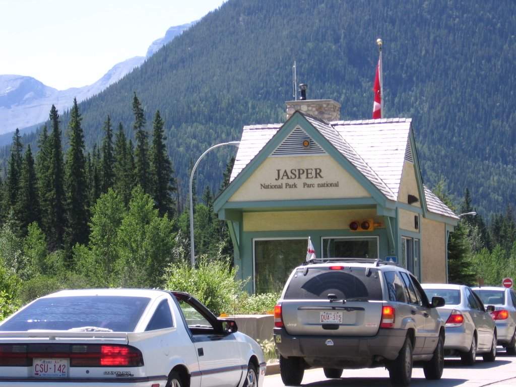 At around the 7 hour mark, I hit the gates to Jasper National Park. Its a truly spectacular drive through this park, one I recommend to anyone. It was here, from the gentleman in the silver Jeep, that I learned that England had lost 3-1 to Portugal that morning in the World Cup. Damn.
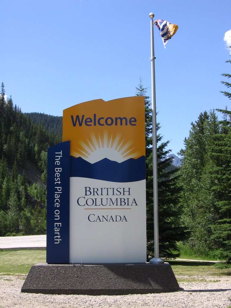
Not too long after passing through Jasper, I hit the BC border. Given that i'm going to be calling BC home for at least the next two years, I thought it was appropriate to take a picture.

Shortly after crossing into BC, a great song came on the satellite radio. You can't really make it out on the display, but the song in question in Sheryl Crow's "A Change Would Do You Good". Clearly this was a positive omen in relation to my upcoming move :)
 I took a lot of pictures of mountains and scenery on the leg between Jasper and Kamloops. The only one i'll post to the blog, though, is this one. Given that I spent Canada Day driving across a part of this country, I thought it was fitting to stop and take a moment (and a picture) to honour one of Canada's greatest citizens of all time.
The mountain you see in this picture is Mount Terry Fox.
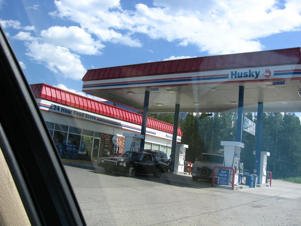
Though scenic, the drive between Jasper and Kamloops is sparsely populated. The halfway point is the town of Blue River, home to this Husky station which is also a major hub for the Mrs. Freshley's Snack Cake Empire (ask William about this).

It took me 45 minutes to finally get past this jerk. I'll be happy never to have this view of him again.
After passing through Vavenby, Avola, and Barriere (site of a nasty forest fire a few summers ago), I finally arrived in the beautiful city of Kamloops.

Even at quarter to six in the evening, Kamloops was VERY VERY hot.
 By this point I was getting pretty hungry and a bit tired, so I decided to stop at my favourite spot in Kamloops, Milestone's. Yes, I know Milestone's is a chain and they're all over BC... but I seem to have a habit of stopping at this one.
This picture was also the only time I took a picture with a Canadian flag that was actually waving... kudos to the driver of that van for having the foresight to park where they did.
 Alright, we're back on the road now for the home stretch. This is arguably the best part of today's drive because its on the Coquihalla Highway, my favourite stretch of road on earth.
I love the Coquihalla.

I REALLY love the Coquihalla.

Descending into the beautiful Nicola Valley and the town of Merritt, home of the Merritt Mountain Music Festival.
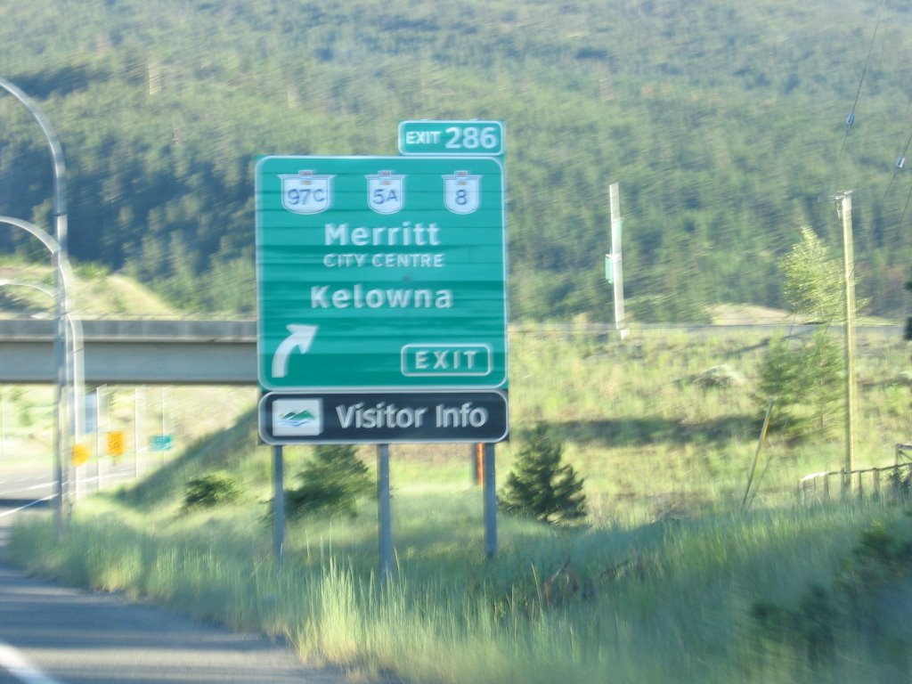
Merritt is also where I get off the Coquihalla and onto the 97 Connector which cuts across to Kelowna. 97C is also an excellent drive and will be just as nice as the Coquihalla once the few remaining sections are twinned.
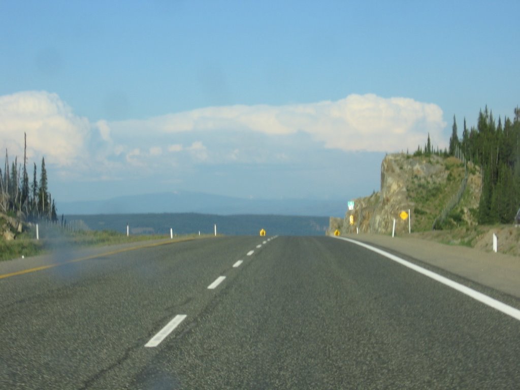 This is the summit of the 97 Connector. At some 1700m (5500 feet) above sea level, this was the highest indicated point during my journey today. From here, the decent into the Okanagan is quite dramatic... so much so that, at one point, my onboard fuel economy read 99.9 mpg.
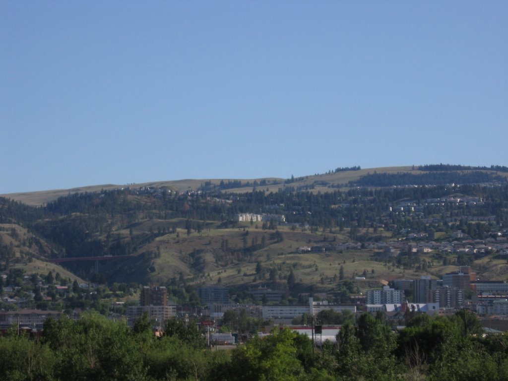
The "final approach" into the valley with a stunning view of Okanagan Lake. This shot could easily be a Group of Seven painting.
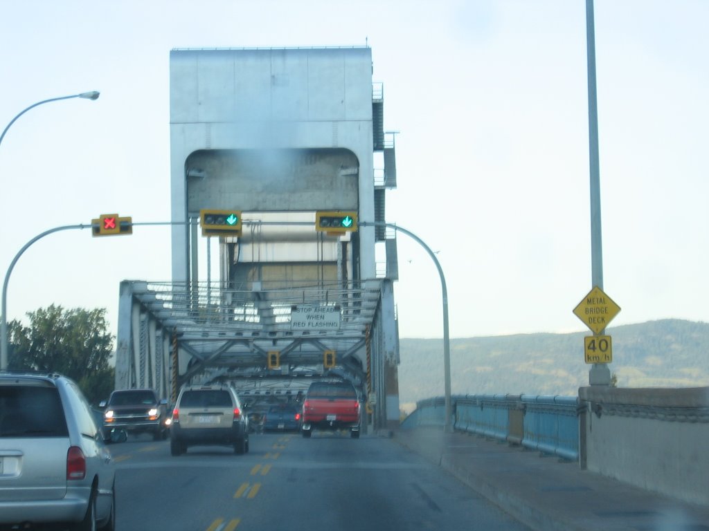
Crossing the floating bridge across Okanagan Lake into the City of Kelowna. This bridge is set to be replaced by a proper bridge by the end of 2008. It will be a welcome relief to both residents and visitors alike, i'm sure.

And finally, after slaughtering a great many insect with my Honda, we arrive at last at the Robert Ponderosa on Bedford Road.
 At 8:28pm Pacific Time, this was the reading on the odometer.
Total distance travelled: 1492km
Total travel time: 15 hours, 21 minutes
Better than AMA TripTik est. time by: 47 minutes
I think this blog needs more pictures of your cute little dog!
ReplyDeletePo' doggie!
ReplyDeleteHoly crap, I can't believe you did that drive in one day.
ReplyDelete130km/h... come on
ReplyDeleteSome more trivia for you. In your "final approach" picture there is a small island about one third in from the right side. The name of this island is Rattlesnake Island. There is a half built mini-golf course on the island which is alittle creepy to say the least, but that's not the interesting part. As the name suggests, the isle is a haven for rattle snakes, which was a problem for the guy who was trying to build the mini-golf, so he released a pig onto the island. You would never guess it, but pigs and snakes are mortal enemies and pigs go absolutely wild on them. The snakes are no match for the pig, whose skin is too thick to be penetrated by the snakes teeth, so they get stomped to death by the pigs. And that is why you won't find any Rattle snakes on Rattle Snake Island.
ReplyDelete